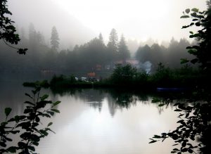
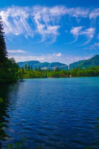
The Karagöller, or Black Lakes, of Artvin province are sprinkled like gems over its emerald highlands, dense forests and permanently snow-capped peaks.
Water is the source of life. It is also synonymous with tranquility. Small lakes, near-puddles, are for us a source of calm, comfort and almost indescribable exhilaration. Appearing unexpectedly in the midst of a forest or surrounded by mountains, they transport us to other realms. There are many such lakes in the remote reaches of Anatolia, and most of them are known as ‘Karagöl’ (‘Kara’: black, ‘göl’: lake). Three such spots of natural beauty, all of the same name, are in the northeastern province of Artvin (in Black Sea region, Turkish Karadeniz Bölgesi).
ŞAVŞAT KARAGÖL
Nestled in the Yalnızçam Mountains, the Artvin township of Şavşat appears to be a typical Anatolian town. As life follows its leisurely routine flow, we pass the Söğütlü Fortress that heralds the Kaçkar peaks, and follow the sign at the turn-off for Veliköy. After kilometer upon kilometer of forest so dense it merges with the blue of the sky, the road ends abruptly and an isolated lake peaks welcomingly through the greenery. The sun is about to disappear behind the trees. The pines on the lake shore make reflections in the crystal clear water, their varied shades of green covering virtually its entire surface. Yellow and white water lilies sway coquettishly in the shallows near the shore. The silence is profound, the whole world hushed. I gaze enchanted at the landscape spread before me. On the eastern side of the Karagöl, at the heart of this sea of forest, lies a small meadow amidst the greenery. This ravishing flower garden, where the busy bees of the Caucasus flit enthusiastically from blossom to blossom, is also a campsite. Tiny insect monitoring stations have been set up in the vicinity. A wide, well-lit road runs around the perimeter of the lake. A stretch of the road has been submerged under the rising lake waters, as has a tiny wooden pier, a hangout for fish now, while a white boat moored to it seems to float free. I am taken aback at the sight of goldfish darting through the water! Left here years ago, they have multiplied and made friends with the sheatfish, carp and trout.
A NATIONAL PARK
One of countless so-called ‘Black Lakes’ in Turkey, Şavşat Karagöl has the distinction of being a national park. Spread over 3766 hectares, Karagöl-Sahara National Park consists of two parts: the Sahara Yayla or Highland, which spreads over the Yalnızçam Mountains, and the lake—Karagöl. This area, which was declared a national park in 1994, is densely covered with spruce, fir and Scotch pine. Karagöl is a reservoir lake which was formed by a landslide. Göze, the highest peak of the Yalnızçam range at 3167 meters, rises in all its glory on the southeast of the lake, which is one of the major wetlands for migrating wild geese in winter. And at Bagat to the northeast, you can enjoy grass skiing, one of Turkey’s lesser known sports.
The area also offers incredible opportunities for those interested in camping and caravan tourism. Former department of forestry housing units serve now as restaurants and pensions, and a series of trekking routes await enthusiasts around the lake at an altitude of almost 1580 meters. Hiking in the verdant green meadows and in the forests that rise all the way to the peaks and wading through the colorful wild flowers are a pleasure all its own. And for those who enjoy observing wildlife, the forests that surround the lake couldn’t be better.
BORÇKA KARAGÖL
Small lakes don’t appear on maps. These natural wonders can only be discovered either by talking with people who live in the area or by following the recommendations of previous visitors. We decided to visit the Borçka Karagöl during a conversation with an employee at the TEMA Foundation Guesthouse, where we stayed in the town of Macahel. To get to the lake, you have to drive 20 kilometers along the Borçka-Camili (Macahel) road and then turn off at the sign for Karagöl and follow the gravel road. Five kilometers later your journey will end at a dark blue lake hidden in the forest amidst mountains that stretch as far as the eye can see. While the sun coyly hides its face in the clouds, everything is suddenly enveloped in mist. Unable to resist the allure of a boat moored to a tiny pier, we start rowing. A section of the lake is covered with reeds. We complete our lake tour to the croaking of frogs. Just as we are about to occupy one of the tables on shore and open our picnic basket, it starts to rain. Apart from the guesthouse of the Artvin Environment Directorate, this nature park offers no other public facilities. There are however camping and picnic areas for nature lovers around the lake.
LIKE A RAIN FOREST
Borçka Karagöl, which was recently declared a nature park, was formed when a hill near the Klaskur Highland collapsed on the Klaskur River

Artvin, borçka Karagöl from Black Sea (Karadeniz) Region of Turkey
in a landslide. This 1430-meter-high lake is almost completely surrounded by mountains. Thanks to high humidity and abundant rainfall year round, Borçka Karagöl has an ecosystem similar to that of the tropical rain forests. In autumn especially, the turning leaves make for a spectacular landscape around this lake, where fishing is prohibited.
BARHAL KARAGÖL
Unlike the lakes of Şavşat and Borçka, Barhal Karagöl, which is hidden among the peaks of the Altıparmak Mountains, can be reached only on foot. At the same time the pass to the Kaçkars, Barhal is located in a valley that flaunts every conceivable shade of green. Leaving the roadway that ends at the Naznara Highland, we follow our guide, Mehmet Karahan, straight into the Altıparmak Mountains. As we slowly wend out way upwards among the nearly 100-year-old timber houses, the forest gives way to green meadows. Once we pass Amanes Highland, snowy peaks appear behind the clouds, like the fingers of a hand outstretched to the sky. And when we reach the waterfall’s frothing cascade, the lake greets us, reflections of the snow-capped summits glinting on its surface. At 2800 meters, Barhal Karagöl is the

Artvin, borçka Karagöl from Black Sea (Karadeniz) Region of Turkey
largest lake in the Altıparmak range, which boasts a total of fourteen glacier lakes large and small. A small island pokes up out of this lake, which is 230 meters long, 130 meters wide and 7 meters deep at its deepest point. The lake at Barhal, located just below the 3492-meter high Karataş summit, takes its name from the Barhal River, which joins the larger Çoruh some seventy kilometers further on. Camping is possible at Karagöl, on whose slopes snow is in evidence even in summer. And don’t be surprised if you encounter some tents even in the sudden thick fogs and inclement weather.
With their historic churches and bridges, permanently snow-capped peaks, crater lakes, verdant highlands and ‘Black Lakes’ sparkling among the trees, the landscapes of Artvin remain forever fresh in our memory.

